
Teesside Archives has recently been posting items online to showcase just what it holds in its vast collection.
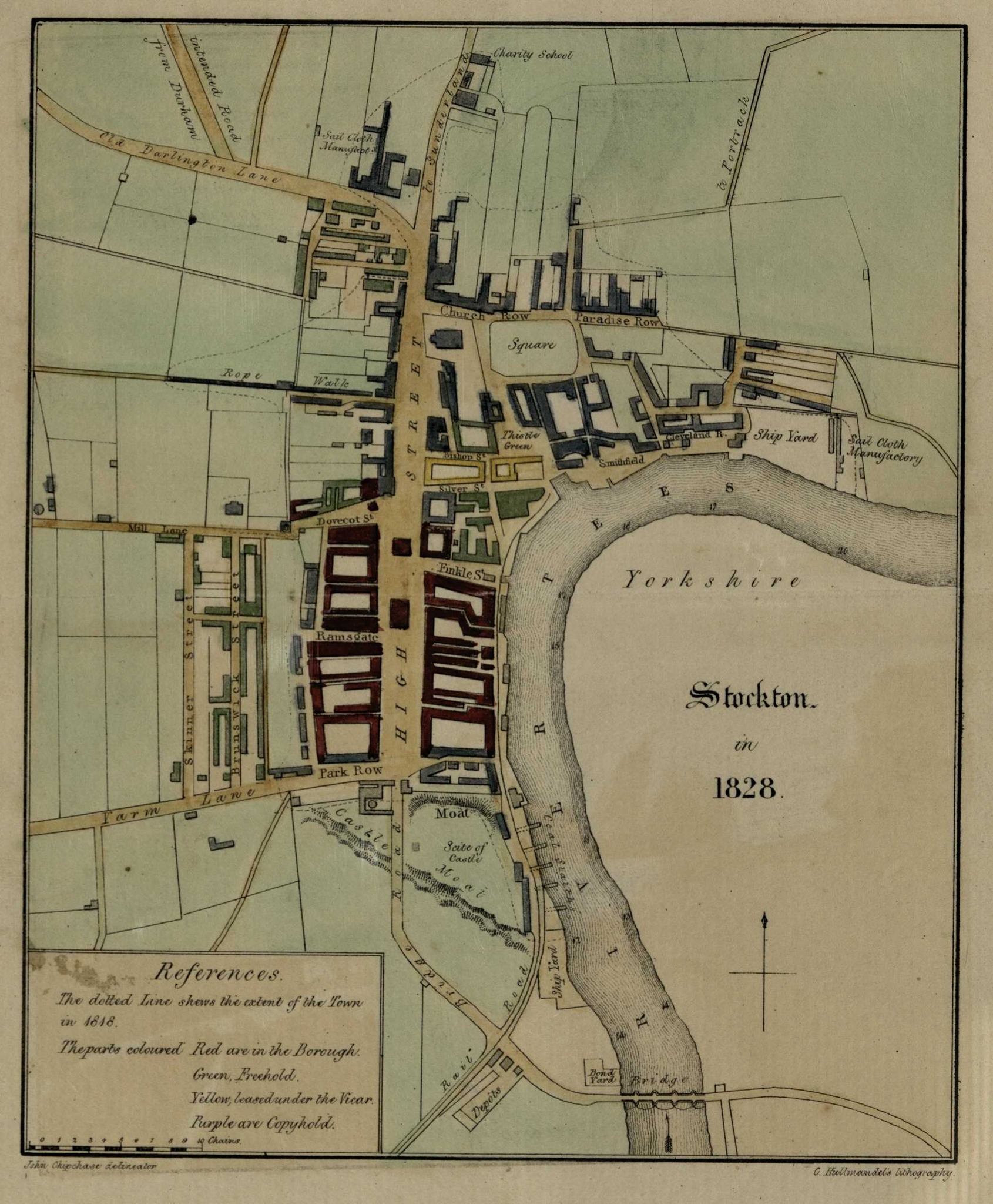
In a recent #MapMonday post on their Facebook page, a map of Stockton-on-Tees from 1828 showed just how different the town was even as recently as the introduction of the railways.
Here’s a picture of the map
Lost Aspects of Stockton-on-Tees
Looking closely at this map, which was produced only three years after the Stockton & Darlington Railway opened, terminating in the town, reveals so fascinating insights into what Stockton was like and just how small the town was only 200 years ago.
Here are some of the things we noticed:
The location of the original village
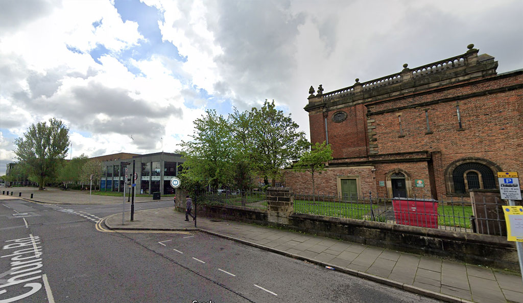
Site of the original village of Stockton today. From Google Maps
Stockton-on-Tees is thought to have first existed around the present day Parish Church (St Thomas’) at the top end of the High Street.
On the map you can see the church, and behind it what is labelled Square. This today is the site of the Central Library and Stockton Borough Council offices, but was once a green at the heart of the original village.
It would have been surrounded by cottages, perhaps inns and other buildings, with the church at the west end.
Lost Yards
In the south-east corner of the High Street you can see lots of small yards and alleyway running towards the river.
These were lost when the Castlegate Centre was built in the 1970s (or perhaps earlier as the High Street grew), and the site was recently cleared completely to make way for a new urban park.
Prince Regent Street Didn’t Exist
To the west of the High Street today is the busy Prince Regent Street.
This is home to businesses and landmarks like the Arc and Ku Bar.
However, back in 1828 it didn’t exist at all, even though streets like Brunswick Street and Skinner Street did (and still do) to its west.
Railways by the River
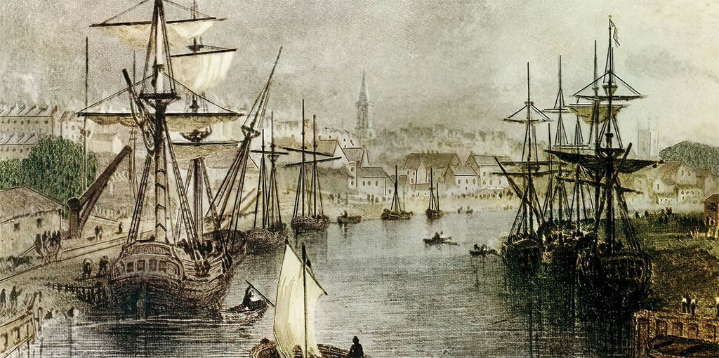
Stockton riverside in 1828. Taken from Middlesbrough A Colourful Past by Paul Menzies
At the bottom of the map you can see the Stockton & Darlington Railway (or Rail Road as it’s labelled) arriving into the town.
The Depot is the original passenger station which still exists today, known as Bridge House.
However, follow the lines and you’ll see the track extends beyond and runs along the riverside.
Back then, Stockton’s riverside was a hive of industry and the river itself was also heavily used for shipbuilding and trade.
The S&DR was built primarily as a means of transporting coal from the Durham coalfields to the port here at Stockton, and these lines allowed the trains to transport the coal directly to the staithes where the ships were loaded.
The Castle
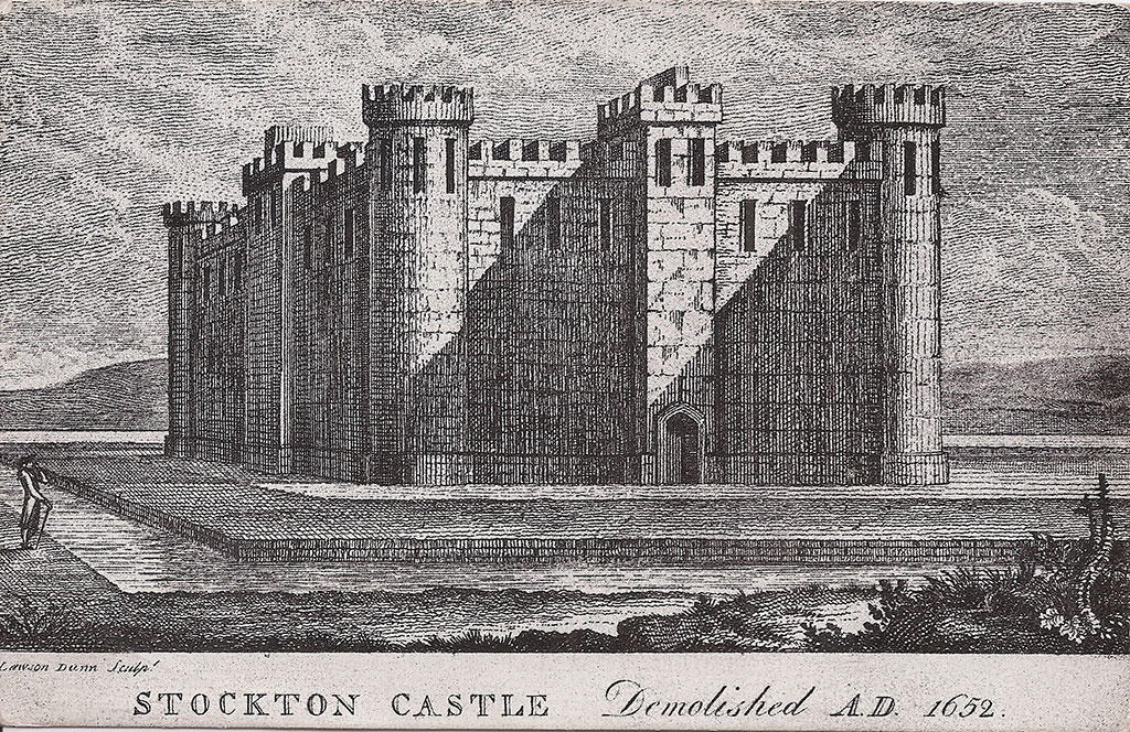
An artist’s impression of Stockton castle. But what did it really look like?
Stockton Castle is still to this day something of a mystery as very little is known for a fact about its size and what it looked like.
Was it just a manor house for the Bishops of Durham, or was it a medival fortress as often depicted?
What is interesting, however, is that even in 1828 the site of the castle is still open and includes surviving features like its moat at the southern end of the High Street.
This site would later be built on by houses and businesses, and ultimately the recently demolished Swallow Hotel. So nothing remains today of the landmark.
Sailcloth Industry
The sailcloth industry in Stockton was thriving around the time of this map.
Ships at this time were still largely powered by sails, and the provision of these was of great need by the shipbuilders in the town, as well as those repairing ships.
You’ll notice sailcloth manufacturers in two places on the map: one on the right side, just above the river (next to the Ship Yard), and the other north of the High Street where the ‘Old Darlington Lane’ (now Bishopton Lane) curves away near what we know as Maxwell’s Corner today.
A Windmill
Although not explicitly labelled as such, there appears to be a windmill marked on the map.
Extending west from Dovecot Street you’ll notice Mill Lane.
This in itself is a big clue as to the windmill’s existence. However, continue west along the lane and you’ll notice a round structure on the right hand edge of the map.
According to this site (https://northeastmills.wordpress.com/mill-research/stocktons-lost-windmills/) a mill existed here until at least the late 1800s, and the presence of Mill Lane Primary School nearby also hints at its existence.
Today Mill Lane is known as Dovecot Street along its length. Another windmill once existed near the coal staithes beside the river.
The Original Stockton Bridge
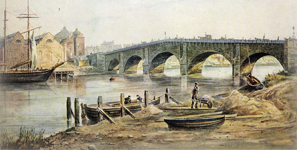
The original Stockton Bridge. Taken from Middlesbrough A Colourful Past, by Paul Menzies
Crossing the River Tees at the bottom of the map, along Bridge Road east of the railway depot, you can see the original Stockton Bridge with its five spans and abutments marked clearly.
This bridge was completed in 1771 and designed by Joseph Robson of Sunderland, and was originally a toll bridge. It replaced Yarm Bridge in importance as a crossing point on the Tees.
Stockton Bridge was eventually replaced by Victoria Bridge, constructed between 1882-1887, and which is still in use today.
Increased road traffic, and also the provision of a new tram line between Norton and North Ormesby necessitated this new, wider bridge. It was named to commemorate the 50th anniversary of Queen Victoria’s reign.
It’s fascinating to look at an old map of a place you know so well and discover what has changed in a relatively short time period.
Thanks to Teesside Archives for sharing it, and please go visit them at the Dorman Museum in Middlesbrough (when it reopens soon) to discover just what else is in their collection!
Follow their blog here: https://teessidearchives.wordpress.com/